Project Highlight: Arenas Palm Canyon Wash/Cherly Creek Levee Certification – Geomorphic Study for Arenas Canyon
Location
Palm Springs, CA
Client
Riverside County Flood Control & Water Conservation District
Project Leads
Jon Fuller, Principal Investigator
Mike Kellogg, Geomorphologist
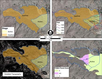
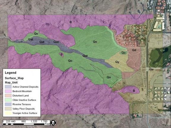
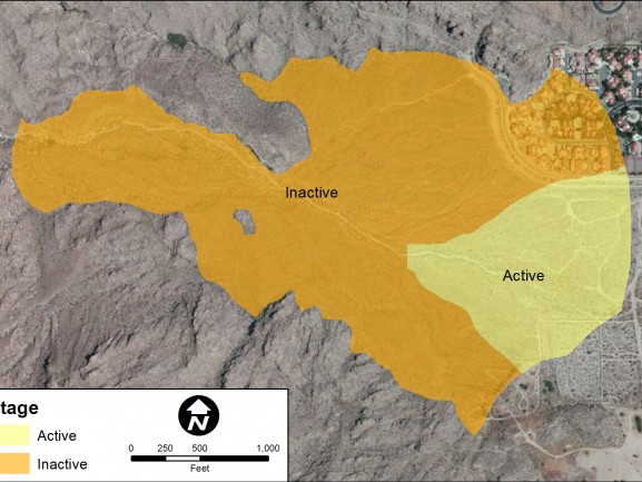
JE Fuller/Hydrology & Geomorphology, Inc. (JEF) completed a Stage 2 floodplain delineation and geomorphic analysis of the Arenas Canyon Alluvial Fan. A Stage 2 delineation consists of identifying the active and inactive portions of an alluvial fan landform, as described in Appendix G of the Federal Emergency Management Agency (FEMA) Guidelines & Specifications for Flood Hazard Study Mapping Partners (2003). The study relied on field- and office-based geomorphic assessment as well as FLO2D modeling of the active fan surface. These key conclusions were reached:
- Arenas Canyon is an alluvial fan landform (Stage 1).
- Portions of Arenas Canyon are an active alluvial fan (Stage 2).
- Only minor portions of the active alluvial fan surface in Arenas Canyon are subject to “ultra-hazardous” flood conditions.
- There is no historical or field evidence of recent channel avulsions, even within the portions of the fan mapped as active in the Stage 2 analysis.
- The active portion of the fan has a relatively low potential for future avulsions due to the low sediment production rate in the watershed, the steepness, alignment, and topography of the active fan area, and the high resistivity to erosion of the bouldery fan surface.
- The Cherly Creek levee and channel are not subject to (ultra-hazardous) active alluvial fan flooding.
- Approximately 10 cfs of runoff from Arenas Canyon reaches the Cherly Creek channel during the 100-year event.
- When the runoff from Arenas Canyon is combined with the 100-year discharge from the Cherly Creek watershed, the 100-year peak discharge is 331 cfs.
- The study results are currently under review by FEMA after having been approved by RCFCD.
